
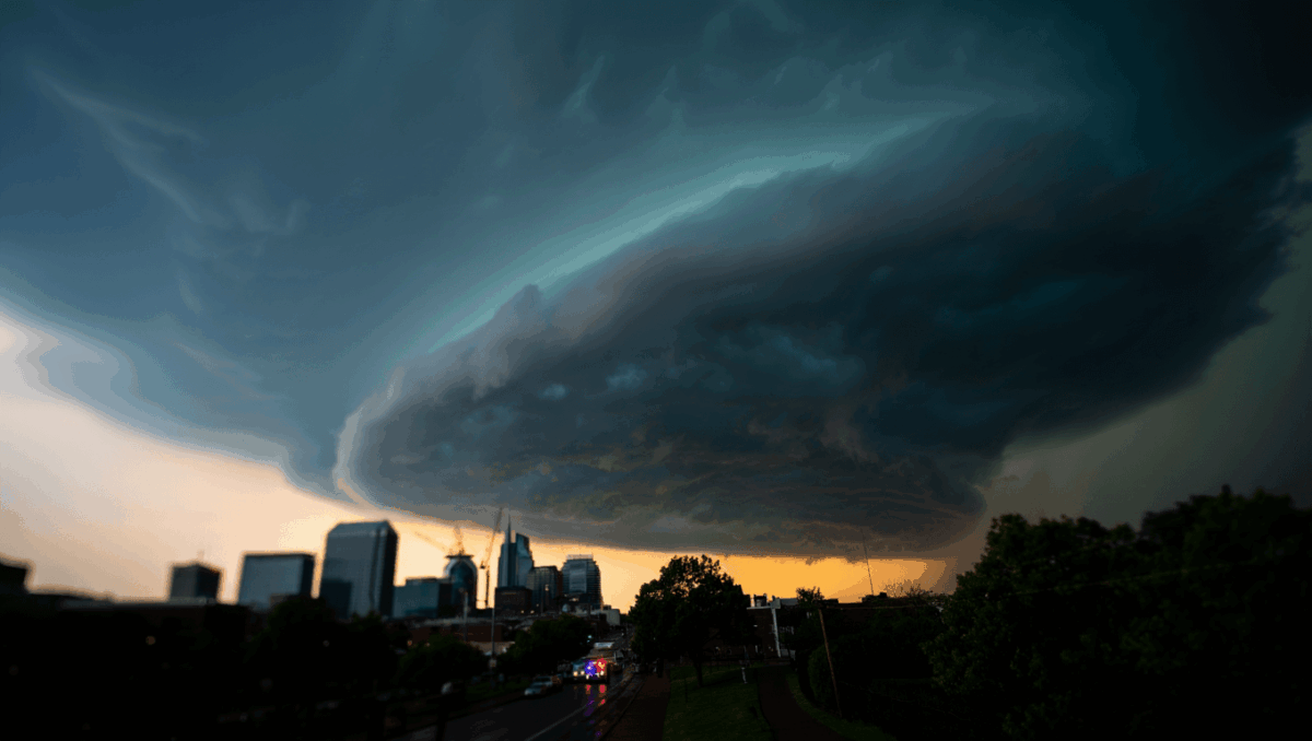
Nashville weather is under a Code Red alert for strong to severe thunderstorms moving through Middle Tennessee tonight. A dangerous cold front will sweep through Thursday evening and Friday morning, bringing damaging winds with gusts approaching 60 mph and a dramatic 30-degree temperature drop that will reshape the region’s forecast for weeks ahead.
🔥 Quick Facts
- Code Red Alert issued by FOX 17 for strong to severe thunderstorms Thursday evening across Middle Tennessee
- Wind gusts could reach 60 mph when storms arrive, with sustained winds exceeding 20 mph throughout the day
- Temperature will drop from highs near 60°F today to lows in the 20s-30s Friday, a 25-30 degree swing
- Severe weather risk is low at 1 out of 5 on threat level scale, with extremely low tornado threat
Code Red Alert Issues for Tonight’s Storm System
Intuit emerges as best software stock for 2026 while stock crashes to bargain levels analysts didn’t expect
2026 tax brackets shock Americans with hidden paycheck truth nobody expected
FOX 17 News declared a Code Red weather alert Thursday afternoon as meteorologists warn of strong to severe thunderstorms moving into the Nashville area this evening. The alert covers Middle Tennessee as a cold front approaches from the northwest, expected to push through the region during the afternoon and evening hours. Rain has been ongoing since morning, but the main threat arrives when the cold front arrives later today.
The timing is critical. Meteorologists expect the heaviest storm activity between 7 PM and 10 PM Thursday, with the front clearing the Cumberland Plateau and moving out of the viewing area by approximately 10 PM. Once the cold front passes, severe weather chances end abruptly, making the evening window the critical period for the region.
Damaging Winds Are the Primary Concern Tonight
Marcus Lemonis takes CEO role at Bed Bath & Beyond with $25M cost-cutting plan and watch what industry experts are saying about his next move
SPX surges 34 points at open with shocking tech recovery, here’s what caused the unexpected Venezuela rally
While severe weather overall is unlikely, the main concern is damaging wind gusts that could exceed 40-60 mph when thunderstorms develop. Forecasters at WKRN Warning Authority note that wind gusts throughout Thursday will remain above 20 mph, creating hazards even away from storms. When isolated severe thunderstorms arrive, the primary threat shifts to strong damaging straight-line winds that could damage trees, partial roof damage, and create dangerous conditions.
The National Weather Service and local meteorologists emphasize residents should secure loose outdoor items, bring in patio furniture, and avoid being near windows during peak storm activity. Heavy rain accompanies the storms, adding flooding concerns to the evening’s weather hazards. However, an isolated tornado is extremely unlikely, with the overall tornado threat described as very low across Middle Tennessee.
Temperature Profile and What Weather Experts Predict
| Time Period | High Temperature | Conditions |
| Thursday Afternoon | Near 60°F | Warm, rainy, thunderstorms developing |
| Thursday Night | Rapidly falling | Severe storms, strong winds, heavy rain |
| Friday Morning | Starting in 20s | Clear skies move in, much colder air |
| Friday Afternoon | Mid-40s | Sunny, breezy, chilly conditions |
The dramatic 25-30 degree temperature drop will occur between Thursday afternoon and Friday morning as cold air rushes in behind the departing cold front. Thursday will feel almost spring-like with temperatures climbing to near 60°F, but Friday morning lows will plummet to the 20s, making for dangerous wind chill values during the predawn hours. Friday afternoon highs will recover only to the mid-40s, remaining well below seasonal average for December 18th in Nashville.
What to Expect After the Cold Front Passes Friday
After Thursday’s severe weather threat ends, a much different weather pattern takes shape for the remainder of December. The weekend turns warmer, with highs returning to near 60°F Saturday, and forecasters are tracking another system approaching Saturday night into Sunday that will bring rain and another cold front. However, a warming trend will eventually take over, with forecast models suggesting temperatures in the 50s to 60s persisting through the final two weeks of December.
Christmas week itself is shaping up to be unusually above average in temperature, with highs potentially climbing into the upper 50s or low 60s. This represents a sharp departure from typical December weather in Middle Tennessee and explains why seasonal concerns about winter storms are growing less likely for holiday travel planning.
Should Nashville Residents Prepare for Tonight’s Code Red Alert?
Yes—residents should take tonight’s severe weather threat seriously, even though the overall risk is categorized as low. Securing loose outdoor items, knowing where to shelter, and monitoring weather updates are essential precautions. The damaging wind threat is real even if widespread severe weather doesn’t materialize. Power outages become possible if strong gusts damage trees and knock down power lines, so having flashlights and battery-powered devices ready is prudent.
Download the official weather apps from FOX 17, WKRN, and the National Weather Service to receive real-time alerts as storms approach your specific location. Cell phone weather alerts will push warnings directly to residents, ensuring no one misses critical safety information. Stay indoors during peak storm activity from 7-10 PM, keep windows and doors closed, and avoid using landline phones during thunderstorms, as lightning poses a secondary hazard.

Patrick Graham is a business and finance journalist translating Wall Street’s complexities into stories that matter to everyday readers. With extensive experience in financial journalism and economic analysis, this expert journalist provides sharp insights on market trends, corporate developments, and the economic forces affecting daily life. His reporting helps readers make sense of the business world’s biggest moves.